
Tìm kiếm
Bắc giang
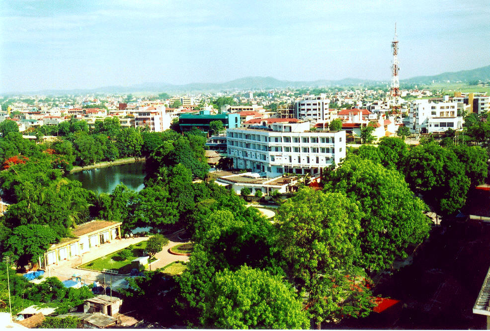
Vị trí
Bac Giang is a mountainous province located in the North-Eastern region of Viet Nam.
The province is a part of the development planning of Ha Noi and surrounding areas until 2030, as well as vision planning by 2050.
Bac Giang is also the large general economic region of the nation in particular and Asia-Pacific area in general. Simultaneously, the province is on the economic corridor of Nam Ninh (China) – Lang Son – Ha Noi – Hai Phong and next to the focal economic zone of northern.
Thông tin dự án
Geographical location:
Bac Giang is situated from the latitude 21007’to 21037’ north and longitude 105053’to107002’ east,in the transitional area between the North-Eastern provinces and the Northern Delta and Hanoi Capital. It borders Bac Ninh and Hai Duong provinces to the South, Lang Son province to the North, Quang Ninh province to the East, Ha Noi Capital and Thai Nguyen province to the West. Administrative units comprise one city (Bac Giang city) and nine districts, of which 6 districts are mountainous ones and 1 district is highland one with the total of 231 communes, wards and towns. Thanks to its geographical location adjacent to the key economic triangle Hanoi – Hai Phong – Quang Ninh, it is quite convenient for Bac Giang to develop and connect with other regions. Bac Giang City is 50 km away from Ha Noi Capital, 110 km from the Huu Nghi Border Gate (Friendship Gate) with China, about 130 km from Hai Phong seaport and Cai Lan deep sea port (in Quang Ninh province). This location makes it quite easy and convenient for the province’s trading with other regions in the country and in the world.
Area:
The natural land area of Bac Giang province is 382,200 hectares, including 123,000 ha of agricultural land, 110,000 ha of forest land, 66,500 ha of urban land, specialized land and residential land. The remaining land area of about 82,700 ha comprises other land types, in which reddish yellow land accounts for the biggest ratio (around 63.13% of the natural land area).
Population:
The province’s population by end of year 2010 was 1,567,557, and the density was 408.1 people per sq.km, higher than the regional and national average. Urban population is approximately 151,000 while rural population is 1,416,614, making up 9.62% and 90.38% of the whole province’s population respectively. The number of people within working age represents around 64.15%, in which 24% received vocational training; poor households account for 9.78%.
Socio-economic situation:
Socio-economy in 2013 kept developing stably and gained positive results: GDP growth rate stood at 9.7% in which industry-construction raised by 17.3%, services by 9.1%, agriculture-forestry-aquaculture by 1.6%.
Export turnover was estimated to reach USD156 million in October, and USD1,328 million for the first 10 months, equal to 80.5% of the year plan andup by 27.9% year-on-year (Y/Y). Export is mainly from FDI sector, gaining USD1,035 million for first 10 months, accounting for 77.9%. Private economic sector obtained USD290 million, accounting for 21.8%.
FDI attraction:
As of year 2013, there were 124 FDI projects in Bac Giang province with total registered capital of USD1809 million, ranking 23rd in the country in terms of registered capital. In 2013 alone, Bắc Giang province granted new investment certificates to 23 projects with total registered capital of USD112.67 million. There were seven projects with growth capital of USD27.57 million. So, in year 2013, the province attracted USD140 million of FDI capital, ranking 18th and making up 0.6% of the whole country’s total FDI capital.
Infrastructure:
Road network: Road network stretches over a length of 9,866.75 km, including 04 National Roads (namely #1A, #31, #37 and #279) with a total length of 251.8 km, accounting for 2.55%; 18 provincial roads of 411.8 km in length, accounting for 4.17%; district roads of 694.5 km, accounting for 7.04%; commune roads of 2,055.6 km, accounting for 20.83%; urban roads of 281.7 km, accounting for 2.86%. Besides, there are roads for special use in industrial parks and walk paths on paddy fields.
Inland waterway: There are 03 rivers in the area of Bac Giang province,namely Thương river, Cầu river and Lục Nam river with total length of 354 km, of which 222 km is under Central Government’s management, 132 km under local Government’s management. This river system can accommodate vessels of 40MT to 500 MT. The inland riverports, river berths such as Á Lữ port, port of Ha Bac Neutrogenous Fertilizer and Chemical Plant, Đám berth and Tuần berth, are relatively modern, harmonious, capable for loading, unloading huge quantity of goods. Á Lữ port with an area of 20,000m2, length of 200m and 02 warehouses of 4,440m2 in area can handle about 250,000 tons of freight per year; specific-purpose port of Ha Bac Neutrogenous Fertilizer and Chemical Plant can handle about 70-100 thousand tons of goods per year. Besides, there are tens of inland ports and berths of small and medium sizes, contributing to the diversification of transport modes and ease of transport pressure on road network.
Railways: There are two railroads crossing the province area, including Hanoi – Đồng Đăng, Yên Viên – Hạ Long, and 01 international railroad between Gia Lâm (Vietnam) – Nanning (China) over a length of about 120km with such stations as: Sen Hồ, Bắc Giang, Phố Tráng, Kép, Bảo Sơn, Lan Mẫu, Bố Hạ, Mỏ Trạng, which can transport huge amount of commodity and big number of passengers.
Apart from three railroads under the Central Government’s management, the province has a railroad specifically used for Ha Bac Neutrogenous Fertilizer and Chemical Plant.
Electricity: All communes in the province have access to the national grid of 220KV, 110KV, 35KV and 22KV. The Sơn Động 220MW thermo-electric Plant of was already put into operation. The distribution line and the 500kV transformer station of Sơn La-Hiệp Hòa, one of the national key projects have started operation.
Water supply: The safe water supply system has received adequate investment and is able to supply sufficient water for urban and industrial parks.
Telecommunication: Mobile phone and high speed Internet (ADSL) network covers almost all communes in the province. Leased Line service is supplied to centres of districts, city, industrial clusters and condensed residential areas. 100% communes, wards, towns have their own post offices.
Potential for development:
Minerals: There are several important materials for industrial development such as pit-coal in Yên Thế, Sơn Động, Lục Ngạn districts with reserves of over 114 million tons, in which Đồng Rì coal mine has reserves of over 100 million tons; iron ore in Yên Thế district is of about 0.5 million tons; copper ore reserves of 100 thousand tons is found in Lục Ngạn, Sơn Động mines; there are more than 600 thousand tons of barite ore; there is gray for production of bricks, bibbley-rocks in Hiệp Hòa, Lục Nam with reserves of more than 8 million m3.
Trade and services: Trading network spreads through out the province area. Credit, banking, insuarance, customs service is good enough for production and business activities.
There are 16 hospitals in the province, including 02 province-level General Hospitals, 05 specialty hospitals, namely: Maternity hospital, Traditional Medicine hospital, Mental hospital, Tuberculosis and Lung hospital, Nursing and Rehabilitation hospital; and 09 district-level General Hospitals. All communes and wards have clinics.
Investment attraction orientation:
Industry:
+ Mechanical and electric-electronics industries:
– Manufacture and assembly of automobile, motorbikes, movers, agriculture machinery;
– Manufacture of power transformers, electric motors and cable;.
– Manufacture of electronic devices and civil electric equipment.
+ Investment locations: Quang Châu Industrial Park (IP), Vân Trung IP, Song Khê – Nội Hoàng IP.
+ Supporting industry:
– Manufacture of automobile, motorbike component and parts;
– Manufacture of electronic, electric components;
– Production of garment accessories.
+ Investment locations: Quang Châu IP, Vân Trung IP, Song Khê – Nội Hoàng IP, Hợp Thịnh (Hiệp Hòa) Industrial Cluster (IC); Xương Giang II IC (in Bắc Giang city).
+Construction material industry:
– Production of ceramic tiles, adobe bricks;
– Investment locations: An Lập IP (in Sơn Động); Hàm Rồng IP (in Lục Ngạn).
– Manufacture of soundproofing sheets, insulated roofing sheet and fireproof sheets.
+Investment locations: Tân Thịnh IC and Đại Lâm IC (in Lạng Giang).
Service sector
+ Trading:
– The Centre for whole sale and goods trading of Kep Station in Lạng Giang.
– Super market and Trading Centre in the South of Bắc Giang city.
– Logistics Centre in Xuân Hương commune (in Lạng Giang).
– IDC port and Logistics Centre in Song Khê commune, Bắc Giang city.
+ Tourism:
– Resort (investment location: Quảng Phúc (Bắc Giang city); Cấm Sơn, Khuôn Thần (Lục Ngạn);
– Eco-tourist park: (investment location: Mỡ Stream (Lục Nam); Rỗ Stream (Sơn Động).
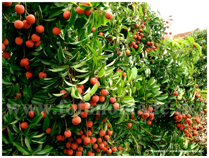
Agriculture
– Meat and poultry processing (investment location: Cầu Gồ IC (Yên Thế); Đồi Ngô IC (Lục Nam).
– Safe vegetable cultivation and processing (Investment location: districts of Việt Yên, Tân Yên, Yên Dũng, Lạng Giang and Lục Nam).
– High-tech aquaculture (Investment location: districts of Tân Yên, Lạng Giang, Yên Dũng).
– Medicinalherbs cultivation (ginseng) (Investment location: Sơn Động district).
Infrastructure development
* Transport infrastructure:
-Improvement of some provincial roads, overhead bridges under the form of BOT or BT.
– Infrastructure in IPs and ICs: development and commercial operation of infrastructure in Vietnam-Korea IP in Tăng Tiến commune, Việt Yên district.
– Development and commercial operation of infrastructure in Đoan Bái-Lương Phong IC (in Hiệp Hoà district), Đại Lâm IC (in Lạng Giang).
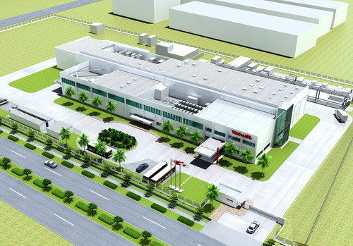
Economic zone, Industrial parks in the province area:
Đình Trám IP:
Area: 127 ha
Location: between the New and the Old National Highway 1A; the National Road #37 runs through this area. The IP is 10km distant from Bắc Giang city, 40 km from Hanoi Capital, 40km from Nội Bài International airport, 110km from Hai Phong seaport,120km from Huu Hi Wuan Border Gate.
Infrastructure: Đình Trám IP was invested from the State budget and has comprehensive and harmonious infrastructure, including: internal roads, rain drainage system, waste collection system, waste water treatment system, telecommunication service, banking, customs service, bonded warehouse, power stations of 110/22/50MVA, 22KV lectricity network, water supply system up to the border of each land plot.
Current status: The IP has almost fully been occupied by over 70 projects.
Vân Trung IP:
Area: 350 ha.
Location: adjacent to the New National Highway 1A; 10km distant from Bắc Giang city; 40 km from Hanoi Capital; 40km from Nội Bài International airport; 110km from Hai Phong seaport; 120km from Huu Hi Wuan Border Gate
Infrastructure: Hong Hai-Taiwan Technical Scientific Corporation has invested in construction of an Industrial-Trading-Service-Urban Complex and a Golf Course on an area of 960 ha, of which 350 ha is reserved for development a High-tech Area for manufacture of desktop computers, laptop, mobile phones, telecommunication equipment and other electronic assessories.
Current status: 04 projects have been granted with Investment Certificate in this IP.
Quang Châu IP:
Area: 426 ha; the adjacent area of 150 hectares is planned for development of an urban area.
Location: adjacent to the New National Highway 1A and Cau River; 15km distant from Bắc Giang city; 33 km from Hanoi Capital; 33km from Nội Bài International airport; 110km from Hai Phong seaport; 100km from Huu Hi Wuan Border Gate.
Infrastructure: internal roads, rain drainage system, waste collection system, waste water treatment system, Quang Chau power station of 110/22/50MVA, 22KV lectricity network, water supply station with capacity of 10,000 cubic meters/day&night to supply safe water up to the border of each land plot; telecommunication service, banking, customs service, bonded warehouse, logiostic service, etc.
Current status: There have been 14 projects operating in the IP.
Song Khê – Nội HoàngIP
Area: 158.7 ha. This area can be expanded up to 300 ha.
Location: adjacent to the New National Highway 1A from Hanoi to Lang Son; 05km distant from Bắc Giang city; 45 km from Hanoi Capital; 45km from Nội Bài International airport; 115km from Hai Phong seaport; 115km from Huu Hi Wuan Border Gate.
Infrastructure: internal roads, rain drainage system, waste collection system, waste water treatment system, telecommunication service, banking, customs service, inland container depot (ICD) bonded warehouse, power station of 110/22KV, lectricity network, water supply system up to the border of each land plot.
Current status: There have been 20 projects operating in the IP